
 Marshall Rare Books
A Directory for the Navigation of the Indian Ocean , with Descriptions of its Coasts, Islands, etc., from the Cape of Good Hope to the Strait of Sunda and Western Australia, including also the Red Sea and the Persian Gulf; the Winds, Monsoons, and Currents, and the Passages from Europe to its various Ports.
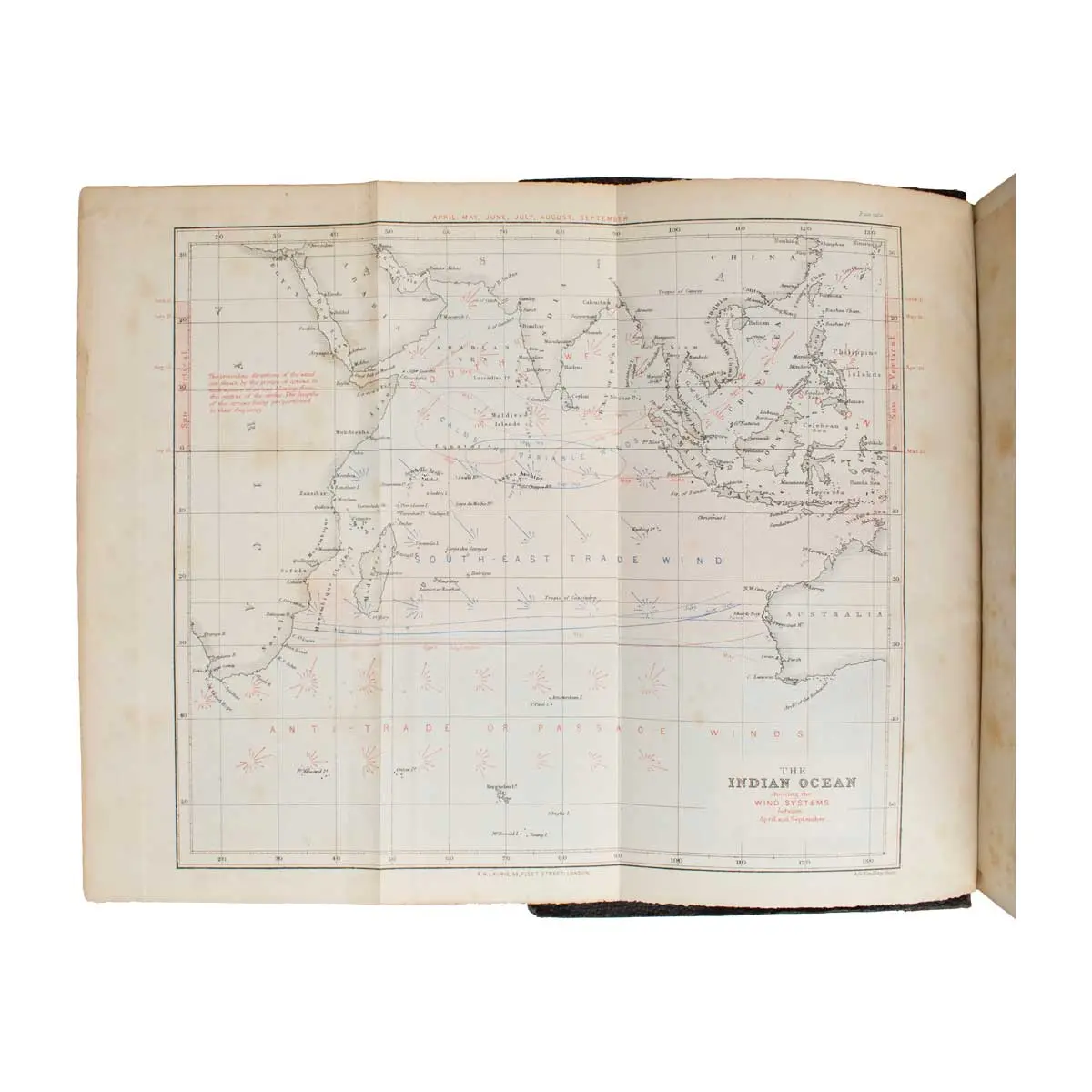
The general maps of the Indian Ocean depict currents and prevailing winds and monsoon directions. Some of the maps of individual islands derive from earlier surveys: the map of the Keeling Islands is that surveyed by Fitzroy and used in the Narrative of the Voyage of the Beagle.
London 1876, thick 4to, Original Cloth Gilt, Gilt Title on Upper cover ‘ Sailing Directory for the Indian Ocean’ hinges repaired (2) xxxvi, 1215, 16 maps mostly folding, this edition is mispaginated there are no pp xi-xii in any 1876 copy of this work.
Third and Enlarged Edition.
In 1876, A Directory for the Navigation of the Indian Ocean by Alexander George Findlay was a comprehensive guide for mariners navigating the Indian Ocean. It detailed coasts, islands, winds, monsoons, currents, and passages from the Cape of Good Hope to the Strait of Sunda and Western Australia, including the Red Sea and Persian Gulf. This third edition, published by Richard Holmes Laurie, provided essential navigational information for sailors of the time.
This work described in detail the Bay of Bengal, The Malabar Coast;
‘The Red Sea’, ‘The Southern Coasts of Arabia’ and ‘The Persian Gulf’ Sharjah (‘Shargeh’), Dubai (‘Debay’) and Abu Dhabi (‘Abu Thabi’) are all described, as is Al Bida and Doha (‘Doheh’) on the Qatar (‘Kutr’) coast, and there are quite long descriptions of Bahrain (‘Bahrein’) and Kuwait (‘Koweit’).
The general maps of the Indian Ocean depict currents and prevailing winds and monsoon directions. Some of the maps of individual islands derive from earlier surveys: the map of the Keeling Islands is that surveyed by Fitzroy and used in the Narrative of the Voyage of the Beagle.
“Between 1869 and 1875 Findlay [1812-1875] prepared and published six navigational directories which in text, maps, and diagrams documented the winds, currents, coastlines, and other information necessary for navigation in the major oceans of the world. The directories ran to several editions and were regarded as the standard authorities” (ODNB). His Indian Ocean directory was first published in 1866.
A friend of David Livingstone, Findlay took a keen interest in exploration in Africa, mapping routes taken by Burton and others.