Marshall Rare Books
Beschrijvinghe van West-Indien door Ionnes de Laet. Tweede druck.
A SPLENDID SET
Leiden: Elzeviers, 1630.
Folio, First Expanded Edition illustrated with engraved title page, text woodcuts and fourteen double page engraved maps of colonised land in North, Central, and South America by Hessel Gerritsz [the first edition contained only ten maps); half-title present; bound in full contemporary Dutch Vellum over boards, ruled and tooled in blind. Uniformly bound with the work described below. Both books are numbered 1 & 2 on the Spines.
A SPLENDID SET
First published as “Nieuwe Wereldt ofte Beschrijvinghe van West-Indien” in Leiden in 1625. De Laet was a director of the Dutch West India Company, and so had access to the latest information, both from the company’s personnel and from the archives. Although an important record – and perhaps the best seventeenth-century account – of the Americas, the real significance of the book is the suite of maps used to illustrate it, drawn by Hessel Gerritsz, official mapmaker to the Dutch West India Company and to the East India Company, chosen in preference to Willem Blaeu.
De Laet maintained the currency of subsequent editions by adding events as they occurred, making this the most complete edition, recording the sacking of Bahia, the conquest of Olinda, Itamaraca, Parahiba, and Rio Grande do Norte.
The work was used as an atlas during the second half of the seventeenth century and is recognized for the accuracy of its maps because Laet had access to the latest geographic data as a director of the Dutch West India Company. Burden points out the new, more open style of engraving which was adopted by Blaeu and Jansson.
The maps in the first edition focussed on South America and the West Indies; with the Dutch settlement on Manhattan, de Laet added new maps of the Americas, maritime Canada, the eastern seaboard from New England to the Carolinas and of the south east. Each of the regional maps was a landmark in the mapping of that region, with huge influence on the work of the Blaeu and Hondius-Janssonius families, and subsequent mapmakers, but none more than the New England map, which is “of extreme importance” (Burden), being the first printed map to name Manhattan (as “Manbattes”), N. Amsterdam (New York), Noordt Rivier (Hudson River), Suydt Rivier (the Delaware) and to use the name “Massachusets” for the nascent English colony in New England.
De Laet was born in Antwerp but in 1585, the family, like thousands of Flemish protestants, fled to the northern Netherlands. After studying philosophy in Leiden the young de Laet travelled to London in 1603, obtained his denizenship, but after the death of his wife returned to Leiden, where in April 1608 he “married Maria Boudewijns van Berlicum (d. 1643). There he made a fortune through overseas trade and land investments, at home and at Laetburg, near Albany, in New Netherland. In 1619 he was appointed a director of the Dutch West Indies Company, a position he held until his death.
“In the ongoing religious quarrels which troubled Holland, de Laet sided with the counter-remonstrants (Gomarists) against the remonstrants (Arminians), an allegiance evident in his ‘Commentarii de Pelagianis et Semi-Pelagianis’ (1617). In 1618 he was delegated for Leiden to the Synod of Dort, where he befriended the theologian Samuel Ward, master of Sidney Sussex College, Cambridge, one of the several English delegates. In his leisure time he proved a prolific, many-sided scholar with a keen interest in theology, geography, botany, classical philology, and comparative historical linguistics. Still of importance are his lavishly illustrated books on the Americas—’Nieuwe wereldt’ (1625), Enlarged (1630) which he also translated into Latin (1633) and French (1640), a detailed account of the early years of the ‘Dutch West Indies Company’ (1644), and ‘Historia naturalis Brasiliae’ (1648). He contributed eleven volumes to the Elzevier ‘Respublicae’ series, including ones on Scotland and Ireland (1627), England (1630), and India (1631). In a magisterial polemic with Hugo Grotius, he disproved Grotius’s claims that the Native Americans originated from China, Ethiopia, and Norway (1644). His de luxe edition of Vitruvius’s ‘De architectura’ (1649) includes his Latin translation of Sir Henry Wotton’s ‘The Elements of Architecture’ (1624). De Laet was an astute Anglo-Saxonist, corresponding and co-operating with (but also envied by) such antiquaries as William Camden, Sir Henry Spelman, Sir John Spelman, Abraham Wheelock, Sir Simonds D’Ewes, John Selden, and Patrick Young. Archbishop James Ussher lent him the famous ‘Caedmon’ manuscript (Bodl. Oxf., MS Junius 11) for an Old English–Latin dictionary he was compiling. His correspondence with John Morris reflects contemporary Anglo-Dutch intellectual exchange, while his unpublished epistolary exchange with Sir William Boswell (d. 1649), English ambassador in The Hague, is a particularly rich quarry for evidence of political and economic interchange between England and Holland.
“In 1638 de Laet visited England for several months both in connection with his dictionary and to obtain denizenship for his son Samuel, who had married Rebecca, daughter of Timothy Cruso of London. During another visit in 1641 parliament asked his advice on the prospects for an English West Indies Company and Charles I requested him to provide the genealogy of his future son-in-law, William II of Orange”
Maps
The maps are attributed to Hessel Gerritsz (see Johannes Keuning, Imago Mundi, Vol. VI, 1949, pp. 48-66). In 1617 Gerritsz was appointed as cartographer of the East India Company, over Blaeu, showing how highly he was esteemed. In 1628, Gerritsz’ interest in the New World led him to take a voyage there (see p. 63 of Keuning’s article), and some of the coastlines in the following maps are from his own first-hand observations. Keuning assesses Gerritsz as follows (p. 66):
Gerritsz…was a very versatile man; we meet him as designer and engraver of maps, prints, and portraits, as a scientific geographer and cartographer, as author, publisher, printer, and bookseller, even as bookbinder. He was unquestionably the chief Dutch cartographer of the XVIIth century, a worthy successor of the founder of the Dutch colonial cartography, Petrus Plancius…to whose authority he owed so much…. His interest in describing anything unknown, or little known regions, was great. The coasts and islands of the Arctic Sea, the northeast and northwest passages to the strait of Annian and India, the routes thither around South America, the Pacific and Australia. With great care he delineated his maps. The progress of the cartography of the world, not only during his lifetime, yet long after him, owes a great deal to his work…. Any of his maps are jewels of the art of engraving…. Most of his maps are soberly executed, without any decoration.
Most of Gerritsz’ work exists only in manuscript, and these maps published by de Laet, are among the only printed Gerritsz maps available to the collector and institution today.
[1] America sive Indiæ Occidentalis Tabula Generalis [title within strapwork cartouche at lower left]. Precedes introduction. North and South America, and a small section of far western Africa are shown. The west coast of North America is delineated to upper California (Mendocino), with Baja California attached to the mainland. One of the most accurate maps of the time in not showing California as an island. Burden, The Mapping of North America 229n (citing the 1630 edition, which is the same as the present map): “The best west coast delineation to date”; and “For the cartographic work he [de Laet] had much to call on, being a director of the Dutch West India Company in charge of all Dutch interests in America…. He also drew upon the fine talents of Hessel Gerritsz, the official cartographer of the Dutch East India Company since 1617.” Jackson, Flags along the Coast, p. 9 (discussing the Gulf Coast and Gerritsz’ map): “Thus did scholarship and statecraft merge, giving Europeans one of the best portraits available of the New World.” Wagner, Cartography of the Northwest Coast, Vol. I, p. 94: “The sanest map of the northwest coast produced in the seventeenth century”; Plate XIX, p. 95, No. 309 (christened by Wagner as the “Laet type”): “Much the best printed map printed up to that date [1630].”
[2] Maiores Minoresque Insulæ. Hispaniola, Cuba Lucaiæ et Caribes [title at upper right within decorative cartouche with beautiful scroll featuring, fruit and floral motif, scale below in centre, compass rose at lower centre]. Precedes the first page of text. The Caribbean Islands to Barbados, including South Florida, the island of Cozumel, Central American isthmus, and northern South America.
[3] Nova Francia et Regiones Adiacentes [title within decorative cartouche at top centre, compass rose at lower right, simple scale at lower left]. Follows p. 30. Canada and New England from Nova Scotia to Cape Cod, including the St. Lawrence River and west to Lake Champlain. Burden, The Mapping of North America 230n: “This map is one of the foundation maps of Canada. De Laet’s reputation was enough to see the map being followed by Blaeu in 1662, and Coronelli as late as the 1690s. It is the first map to include an accurate Prince Edward Island, and the earliest depiction of a north-south orientated Lake Champlain.” Kershaw, Early Printed Maps of Canada, pp. 86-88.
[4] Nova Anglia, Novum Belgivm Et Virginia [title at top left with decorative cartouche with leaves and flowers, two compass roses, simple scale at lower left]; Bermuda majori mole expressa [inset map at lower right]. Follows p. 62. Coast of North America from Nova Scotia to just south of the North Carolina Outer Banks. Burden, The Mapping of North America 231n: “One of three maps that relate to the east coast of North America in de Laet’s work. This is arguably one of the finest descriptions of the Americas published in the seventeenth century. It is a map of extreme importance being the first printed map to use the names Manbattes (Manhattan), and New Amsterdam, or New York…. It is also the earliest to use the Dutch names of Noordt River and Zuyd Rivier, for the Hudson and Delaware Rivers respectively, as well as the Indian Massachusetts, for the new English colony. It influenced many later maps in their depiction of the East coast…. [Gerritsz’] depiction of the coastal area between Chesapeake Bay and Cape Cod is by far the finest yet seen.” Cumming, The Southeast in Early Maps 35n. McCorkle, New England in Early Printed Maps 630.1. Schwartz & Ehrenberg, The Mapping of America, p. 105n. See also Stokes, The Iconography of Manhattan, Vol. 2, pp. 86-88, 141 & Vol. 6, pp. 261-261.
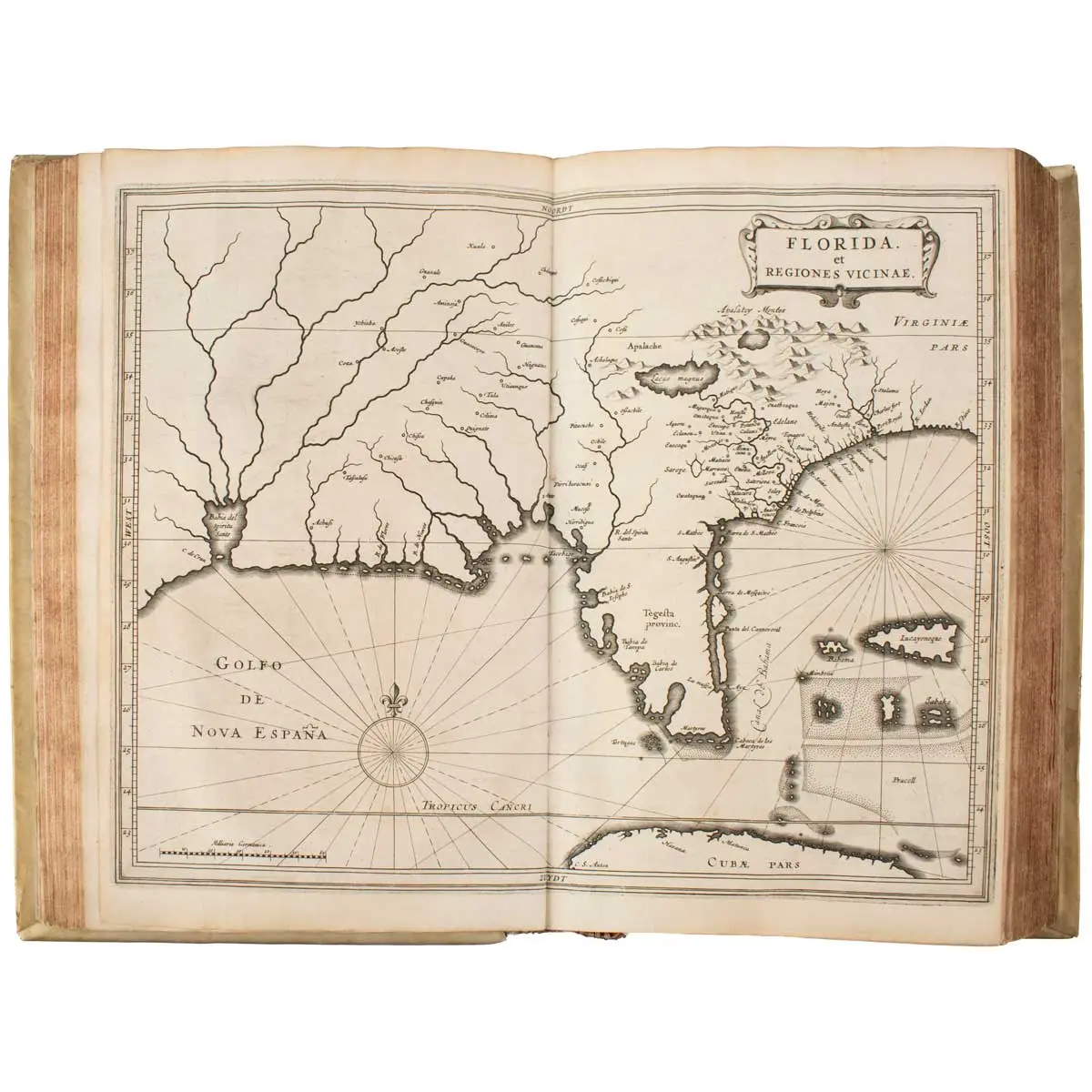
[5] Florida et Regiones Vicinae [title at upper right within strapwork frame, compass rose at lower right]. Follows p. 94. Atlantic Coast and interior from South Carolina to roughly Galveston Bay in Texas, showing extensive river systems in Texas and the rest of the interior regions. Burden, The Mapping of North America 232n: “Despite the fact that he drew on a large number of sources for his information, no fresh material had been forthcoming for decades, Hessel Gerritsz, the author and probable engraver of the map, drew therefore on the interpretation by Claesz c. 1602, of the Jacques le Moyne cartography of Florida. Originally thought to be taken from Jodocus Hondius’ map of Virginia and Florida, 1606, this study demonstrates otherwise. One notable area of alteration is the placing of C. Francois further east into the Atlantic Ocean. Florida, as we know it today, is here called Tegesta province. This name, applied here for the first time, is that of a tribe of Indians living on the south-west coast. ‘Florida’ was at this time applied to a far larger region. It came to be used solely for the peninsula as Spanish Florida was squeezed south by the expansion of the English…. The map’s influence was quite considerable. Blaeu, Janssonius, and Sanson, all followed it.” Brinton, Notes on the Floridian Peninsula, p. 84 (complaining about the lack of good cartography of Florida in the seventeenth century except): “That inserted by De Laet in his description of the New World, called Florida et Regiones Vicinae (1633), is noteworthy because it is one of the first, if not the first, to locate along his supposed route the native towns and provinces met with by De Soto.” Cumming, The Southeast in Early Maps 34n. Jackson, Flags along the Coast (good discussion of the Gulf Coast noting the static cartographical depiction of it until Gerritsz), pp. 7-11: “De Laet reshaped notions of the interior…. His Gulf Coast is a distillation of portolano-type charts produced by the cartographers of many nations (especially Portugal)…. Gerritsz, by adopting this coast model, did much to perpetuate it…. Blaeu was not the author of the most influential Gulf map of the seventeenth century—Hessel Gerritsz was, a fact that most cartographic historians have overlooked.” Lemmon, et al., Charting Louisiana: Five Hundred Years of Maps, p. 12. Lowery 123n. This map is an important and overlooked map in the literature of Texas cartography, other than by Jack Jackson. In the section on the expeditions of Alvarado and De Soto, the author refers to the area they traversed as “Provinciæ nomen de los Vaqueros.”
[6] Nova Hispania, Nova Galicia, Guatimala [title at lower left within cartouche with scrolls and face, below which is a large scale, compass rose at centre below]. Follows p. 220. Mexico from the far upper northwest section at Sinaloa south to Honduras and Costa Rica. The Rio Grande in Texas is shown by its old name, “R. Escondido.” Bornholt, Cuatro Siglos de Expresiones Geográficas del Istmo Centroamericano Plate 50n p. 98 (noting the similarities to the later maps of Ogilby and Montanus). Burden, The Mapping of North America 215n: “Although many maps had been produced of New Spain, few extended north into the area of present-day Texas. The Rio Grande [sic: i.e., Soto la Marina] is here still named the R. de Palmas. The B. del Spiritu Santo possibly represents the Mississippi River. Some authorities have questioned this usual assumption. On the west coast of Florida we find the landing place of Juan Ponce de León. The delineation of the coastlines, particularly of the Gulf of Mexico and the north-west coast of Mexico, was the most accurate to date. The map appeared in Dutch, 1630 [present edition], Latin 1633, and French, 1640.” See Jean Delanglez, El Rio del Espíritu Santo: An Essay on the Cartography of the Gulf Coast and the Adjacent Territory during the Sixteenth and Seventeenth Centuries (New York: United States Catholic Historical Society, 1945).
[7] Terra Firma item Nuevo Reyno De Granada atque Popayan [decorative cartouche at lower right with droll face, flower, large leaf, and strap work, scale below, compass rose at centre left]. Follows p. 346. Northern and northwestern areas of South America, including Colombia, with extensive development of the interior areas.
[8] Peru [decorative cartouche at top left with droll face and incorporating fancy scale, compass rose]. Follows p. 396. Coastline and well-developed interior areas. North is to the left. Included is “Viticos,” the last capital of the Incas. Although abandoned after the conquest, Vitcos was noted by Mercator and other mapmakers until around 1740. In 1911, Hiram Bingham and the Yale Expedition rediscovered the ruins of Vitcos in the Vilcabamba Valley region, but he then went on to find Machu Picchu, which so entranced him that he left Vitcos to oblivion. Today it has become an “off-the-beaten-track” destination for visitors.
[9] Chili [decorative cartouche at top left with face, fruit, and ribbons, large scale at top right, scroll with place names at centre, compass rose at upper centre]. Follows p. 470. Coastline with little interior detail. North is to the left.
[10] Provincia Sitæ Ad Fretum Magallanis itemque Fretum Le Maire [decorative cartouche at upper right, scale on scroll at lower left, compass rose below centre]. Follows p. 500. Coastline and Strait of Magellan from Tierra del Fuego to southern Argentina. North is to the right.
[11] Paragvay, Ó Prov. De Rio De La Plata: cum adiacentibus Provinciis. quas vocant Tvcvman Et Sta. Cruz De La Sierra [decorative cartouche with face, fruit, and vines, with scale above, compass rose]. Follows p. 520. Rio de la Plata region of Brazil west to the Chilean coast and north to Peru.
[12] Provincia de Brasil cum Adiacentibvs Provinciis [very fancy cartouche with two faces and botanical motifs at top centre, scale on scroll below, compass rose]. Follows p. 540. Eastern and northern coastline of Brazil. North is to the right. Primarily coastal towns and islands are shown. The Dutch got busy and in 1629 succeeded in colonising Brazil. The present map is the same as appeared in the 1630 edition, and it is informative to compare the changes that were made for the French edition of 1644 (see JCB Image 3502-1), which has a plethora of interior locations added.
[13] Guaiana siue Provinciæ intra Rio De Las Amazonas atque Rio De Yviapari siue Orinoqve [title within floral cartouche at top right, scale at lower left]. Follows p. 624. Northern coastline of South America from roughly the Amazon River to Trinidad Island.
[14] Venezuela, atque Occidentalis Pars Novæ Andalusiæ [title within cartouche with three faces, one with wings, scale at lower right within strapwork border, compass rose at lower centre]. Follows p. 666. Coastline of Venezuela with little interior development.
First edition in French (first edition in Dutch, 1625, expanded and improved in 1630, also in Dutch, with four regional American maps and other material not in the 1625 edition).
This work is “one of the most famous contemporary descriptions of the natural history of the New World” (Streeter Sale 37) and one of the early atlases to focus exclusively on America after Wytfliet’s atlas of 1597 (see herein) and Herrera’s 1601 atlas (see herein). The first edition (Leyden, 1625) had only ten maps. This is the First Edition with 14 maps. The maps added to subsequent editions are very important for North American cartography (see individual maps above and text below). Asher 3. Borba de Moraes, p. 451: “Graesse affirms that this French translation was made by the author himself.” JCB I (2, 1600-1658), pp. 246-247. European Americana 1633/65. Field 849 (citing Dutch 1640 edition). Hough & Hough, Lesser Antilles 31. Palau 129560. Phillips, Atlases 1149: “Maps like the edition of 1630.” Pilling 2162. Rahir, Les Elzevier 367. Rodrigues 1352. Sabin 38557. Streeter Sale 37. Streit II:1619. Tooley’s Dictionary of Mapmakers Revised Edition, Vol. II, pp. 158-159. Vail 84. Willems, Les Elzevier 382. Winsor IV, p. 417 (referred to as the “standard seventeenth-century work on New Netherlands” and “the map Nova Anglia is one of the first to use the name Manhattan”).
Laet’s work is one of the most important seventeenth-century New World histories. Laet had access not only to published sources but also to Company documents, private correspondence, and other materials. Laet systematically discusses early exploration and settlement of various European colonies in the Caribbean and North and South America (including the Spanish Southwest, Cabeza de Vaca, Oñate, Espejo, et al.; Francis Drake’s voyage to California; etc.) and provides extensive notes on the natural history, anthropology, and languages of Native Americans. (Certain of the author’s remarks on the origin of Native Americans in this work involved him in a famous controversy with Grotius.) He gives an extensive bibliography of sources consulted (pp. [14-15]), including Herrera, Ercilla y Zúñiga’s epic poem, Ramusio, López de Góngora, Lescarbot, John Smith, and Ximénez. (If he actually owned a copy of each book listed, he had an enviable Americana library.)
The maps for the original edition of 1625 were made by Dutch cartographer Hessel Gerritsz (1581-1632), former apprentice of Willem Blaeu, and Blaeu’s predecessor as chief cartographer of the Dutch East India Company. The four maps added to the 1630 and subsequent editions were: America Sive Indiae Occidentalis; Nova Francia; Nova Anglia; and Florida et regiones vicinae. These four maps served as prototypes for the mapping of North America through the seventeenth century. The map of New England is the first printed map of New Netherlands, and the first to name New Amsterdam and Manhattan (“Manbates”); it was probably the prototype for Visscher’s landmark Novi Belgi, and it has been conjectured that the depiction of the Chesapeake area was copied by Champlain in his map of 1632 (Schwartz & Ehrenberg, p. 103, Plate 57; Cumming, The Southeast in Early Maps 35; Heidenreich, Explorations and Mapping of Samuel de Champlain, Cartographica #17, p. 92).The influential Newfoundland outline in the New France map (with numerous French and Portuguese place names) was utilised by Coronelli and Visscher (O’Dea, The Seventeenth Century Cartography of Newfoundland, Cartograpica # 1, pp. 20-21). The Florida map includes one of the earliest appearances of the word ‘Teguesta” for Florida and shows the “Bahia del Espiritu Santo” (Cumming 34); Sanson utilised this depiction in 1650 and 1656 (Delanglez, El Rio de Espiritu Santo, pp. 81-87). The western hemisphere map, based on the account of the Cabrillo expedition published by Herrera in 1615, is considered by Wagner to be “the sanest map of the of the northwest coast produced in the seventeenth century” (pp. 94 & 306, Plate 309), but given the hold of imaginary cartography, little advantage was taken of the map until Delisle borrowed from it about the year 1700
Alden & Landis 640/111; Borba de Moraes I:451; Johnston Cleveland 196; Sabin 38558; Williams 497
WITH
Laet, Johannes de (1581-1649)
Historie Ofte Iaerlijck Verhael Van de Verrichtinghen der Geoctroyeerde West-Indische Compagnie.
Leiden: Bonaventure ende Abraham Elsevier, 1644.
First and only edition, folio; woodcut printer’s device to title, title page printed in red and black, illustrated with thirteen double page maps and views of Dutch colonies in the Americas; bound in full contemporary Dutch Vellum over boards, tooled and ruled in blind, cloth ties renewed, slight worming trail to five first leaves. Uniform with the above work.
De Laet was the director of the Dutch West India Company, in addition to being a knowledgeable geographer in his own right. His history of the WIC has been described as one of finest descriptions of the Americas written and printed during the 17th century. The present work tells many stories of adventure carried out by the WIC in the first third of the 17th century, including a detailed account of Jan Janszoon van Hoorn’s 1633 privateering expedition commissioned by WIC to steal silver from the Spanish, which resulted in the sacking of Campeche, Mexico and the burning of Trujillo, Honduras. This series of exploits by the Dutch were a great blow to the hitherto extant Spanish domination of the Caribbean. Also of note, two Maya pilots living under Spanish colonial rule are said to have willingly participated in the catastrophic sacking of Campeche in direct opposition to their Spanish occupiers.
Tiele 630; Willems 571; Asher 22; Sabin 38556; Alden & Landis II, p.444.
Books you may also like
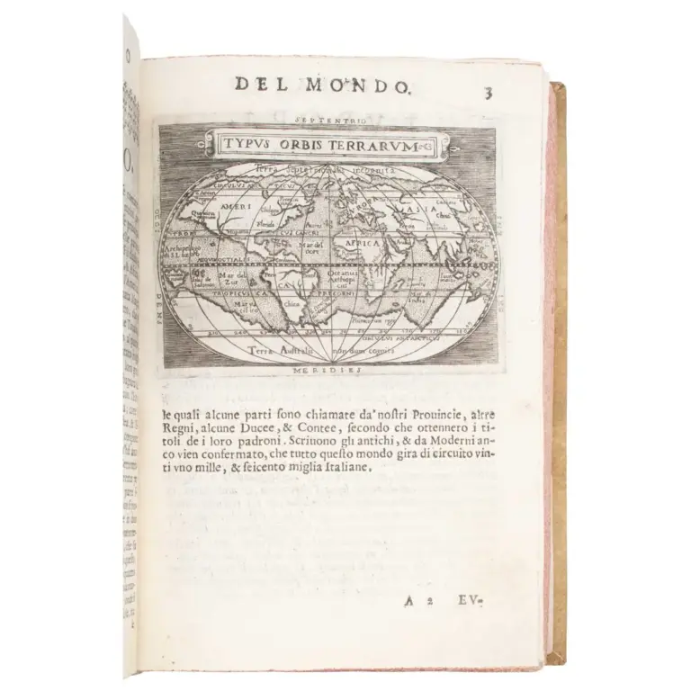
Il theatro del mondo nelquale distintamente si dimonstrano in tavole tutte le provincie, regni e paesi … ridotto dalla forma grande in questa piccola…
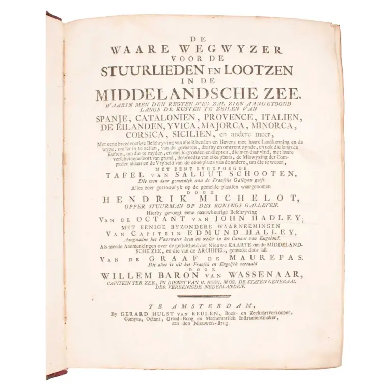
De Waare Wegwyzer voor de Stuurlieden en Lootzen in de Middelansche Zee … Hierbygevoegt eene naauwkeurige beschryving van de octant van John Hadley