
 Marshall Rare Books
Cosmographey: das ist Beschreibung aller Länder Herrschaffen und für nemsten Stetten des gantzen Erdbodens.
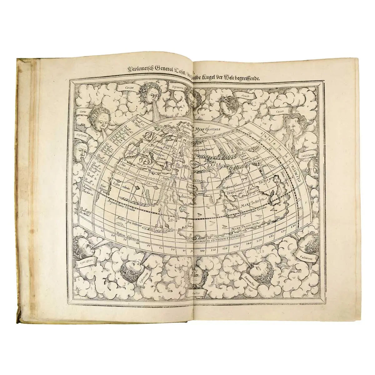
Basel: Sebastian Henricpetri, 1614, Folio (362 x 232mm.), title printed in red and black with woodcut portrait of Münster, large woodcut device at end, 26 double- page woodcut maps, 70 double-page maps and plans (2 folding panoramas), approximately 1040 woodcut illustrations including maps, views and other subjects in the text, Contemporary vellum, title in manuscript to head of spine, title-repaired without loss.
Basel: Sebastian Henricpetri, 1614, Folio (362 x 232mm.), title printed in red and black with woodcut portrait of Münster, large woodcut device at end, 26 double- page woodcut maps, 70 double-page maps and plans (2 folding panoramas), approximately 1040 woodcut illustrations including maps, views and other subjects in the text, Contemporary vellum, title in manuscript to head of spine, title-repaired without loss.
One of the most popular treatises of the sixteenth and seventeenth centuries, the Cosmographia reached a total of forty-six editions in six languages by 1650, each incorporating additions and revisions. Münster was a professor of Hebrew at Basel University and a most distinguished Hebraist, linguist, mathematician, and geographer. This encyclopaedic work was his major undertaking. In its completion, which occupied him for fifteen years, Münster received the assistance of more than one hundred and twenty collaborators, who provided him with the most up-to-date information relating to the towns and places described.
The Cosmographia is profusely illustrated with woodcut town plans and views (many double-page), including some of the earliest published large-scale views of European cities, portraits, coats of arms, costumes, customs, mining and other activities, cannibalism, natural history subjects, &c., by Hans Holbein, Urs Graf, Hans Rudolph Manuel Deutsch, David Kandel, and other artists.
The scientifically most valuable sections are those which deal with Germany and Central Europe. In addressing his German colleagues for information, Münster outlined fairly detailed directions, devising the first known example of a simple plane-table survey. Included are separate sections on the Holy Land, Africa, and Asia, while contained on pages 1099-1112 under the title De Novis Insulis, quomodo, quando & per quem illae inventae sint, is a description of America, with relations of the voyages and discoveries of the early explorers, Columbus, Vespucci, Magellan, &c.
The Tabula novarum insularum is “the first map of the two American continents showing continuity between North and South America and no connection with any other landmass.” (Schwartz & Ehrenberg, The Mapping of America, pp. 43-45, Plate 78).
All of the maps had originally appeared in Münster’s 1540 edition of Ptolemy, except the modern world map was recut with several changes by David Kandel for the 1550 editions of the Cosmographiae.
Finally, the book has the Latin and Hebrew versions of the so -called Prester John letter, the spurious account of a legendary Christian kingdom in the East. Pp. 1161-1162 in Hebrew.
Shirley, The Mapping of the World, 92 & 76; Borba de Moraes II 90; BM STC German p. 633; Burmeister, Münster, 89; Sabin 51381. Bell M523, Harrisse 300, The World Encompassed, 272 ;Nordenskiold, Facsimile Atlas, pp. 108-09 & 24.