
 Marshall Rare Books
Geografia cioe Descrittione Universale della
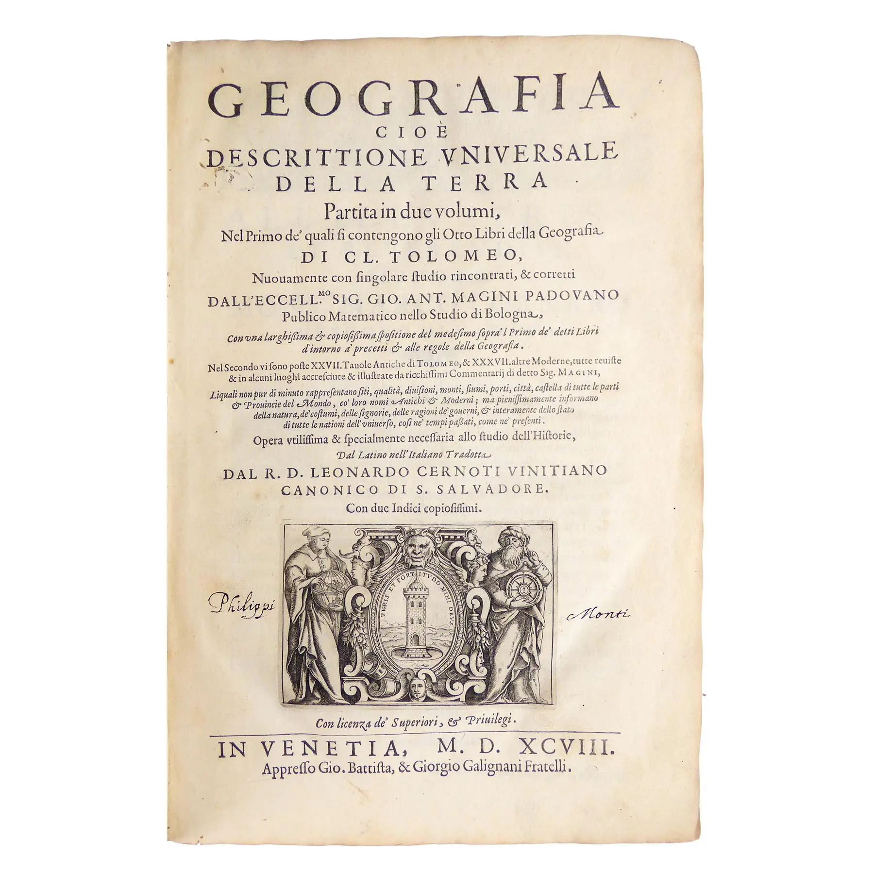
Venice: Gio.Battista & Giorgio Galignani Fratelli, 1598 - 1597. - 2 parts in one volume. 4to.,bound in 6s (12 x 8 4/8 inches). Two vignette title-pages. One full-page engraved double-hemisphere map of the world "Orbis Terrae Compendiosa Descriptio" by Girolamo Porro after Rumold Mercator to D1v, and 63 fine engraved half-page vignette maps, numerous woodcut diagrams and vignettes in text including two of the armillary sphere and woodcut initials. Contemporary mottled calf gilt, spine restored.
Venice: Gio.Battista & Giorgio Galignani Fratelli, 1598 – 1597. – 2 parts in one volume. 4to., bound in 6s (12 x 8 4/8 inches). Two vignette title-pages. One full-page engraved double-hemisphere map of the world “Orbis Terrae Compendiosa Descriptio” by Girolamo Porro after Rumold Mercator to D1v, and 63 fine engraved half-page vignette maps, numerous woodcut diagrams and vignettes in text including two of the armillary sphere and woodcut initials. Contemporary mottled calf gilt, spine restored.
First edition in Italian, edited and corrected by Giovanni Antonio Magini and translated from his Latin edition of 1596, also printed in Venice, into Italian by Leonardo Cernoti. All the maps, 27 of the ancient world, and 36 of the modern world were first published in Magini’s earlier Latin edition, except for Girolamo Porro’s four small format world maps based on Valgrisi’s 1561 edition. The double-hemisphere world map “Orbis Terrae Compendiosa Descriptio” is a reduction of Rumold Mercator’s world map, and is described by Shirley as ‘an exceptionally fine engraving in its own right’. The other three are after Mercator and Ortelius, each and the map of America in chapter XXXIIII (18 pges), show Chili with a distinctive bulge.
Following the descriptions of the Zeno Brothers, the maps showing the Arctic and the North-West Passage have been enlarged and included in the World Map, America and Asia. They show the Straits of Anian as a large waterway between the American Continent and the Arctic. The Arctic is a series of Islands.
Ptolemy’s Geography, arguably the most influential cartographic account of the ancient world, was the point of reference for all Renaissance mapmakers. His compilation of what was known about the world’s geography in the Roman Empire during his time (ca 90-168 ad). He relied on the work of others, in particular an early geographer, Marinos of Tyre, and on gazetteers of the Roman and ancient Persian Empire. He was a Roman citizen of Egypt who wrote in Greek. He was a mathematician, astronomer, geographer, astrologer, and poet (of a single epigram in the Greek Anthology). He lived in Egypt under Roman rule, and is believed to have been born in the town of Ptolemais Hermiou in the Thebaid. He died in Alexandria. The earliest known manuscripts of Ptolomy’s “Geographia” date to about 1300. The first printed version was published in 1477, then 1488, and in Ulm in 1482. The present edition, published at the end of the 16th century, reflects the most important discoveries of that era.
Sabin 66506; Phillips, Atlases, 405; Adams M-118; Shirley 193-96