
 Marshall Rare Books
La Geografia di Claudio Tolomeo Alessandrino. Translated from the Greek by G. Ruscelli.
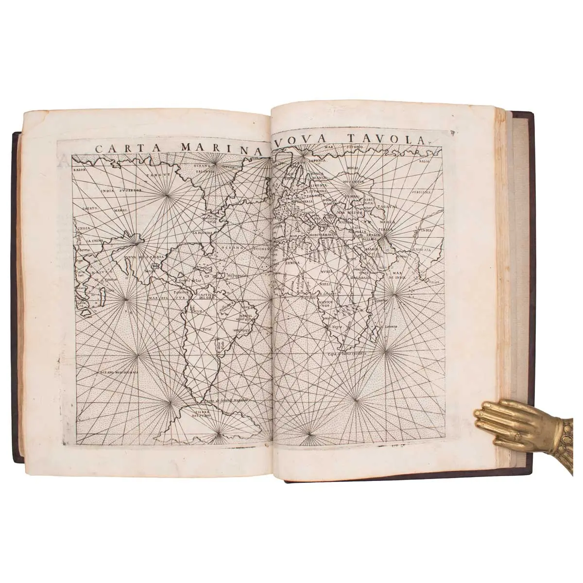
This edition of Ptolemy includes early examples of maps concerned with the search for the North West Passage.
Venice: Giordano Ziletti, 1574-73. 3 parts in one volume, 4to (225 x 157mm). Each part with separate title-page, woodcut illustration of Ptolemy on *2, repeated on *4v, with 65 engraved double-page maps (of which 27 are of the ancient world and 38 of the modern world), woodcut illustrations and initials, with the 3 blanks H4, 4, and H6, later full calf gilt with gilt boss on covers, minor worming to the top margin of a few maps in the Ancient Geography section but not affecting the images, a little occasional browning to a few text leaves but an attractive copy of this important edition.
This edition of Ptolemy includes early examples of maps concerned with the search for the North West Passage – the Zeno Brothers map showing a wide strait beyond the southern tip of Greenland, and the Gastaldi map with America and Asia separated by a narrow strait.
This is Ruscelli’s translation of Ptolemy, the first revised and corrected by Giovanni Malombra. The maps and text are the same as those in the preceding two editions, and the Latin edition of 1562 but one new map has been added, ‘Territorio di Roma’ (no. 13). The table is bound in a different order.
Giacomo Gastaldi, one of the leading cartographers of the sixteenth century, composed a set of maps for an edition of the ‘Geographia’, published in Venice in 1548. It is among the earliest examples of his work, in a long and distinguished career. Despite being prepared on a small format, the maps are clearly and attractively engraved. Gastaldi was the first to add regional maps of the American continent, with important maps of the eastern seaboard, a map of what is now the southern United States, of South America, and separate maps of Cuba and Hispaniola.
Gastaldi’s maps were re-engraved on a slightly larger format for this edition published by Vincenzo Valgrisi, in Venice, in 1574. For this edition, Valgrisi (or the editor Girolamo Ruscelli) added four maps: a double-hemisphere map of the World (the first appearance of this projection in an atlas), a map of Brasil and amongst the most important of these is the second appearance (and first widely circulated) of the famed Zeno map. It shows Greenland connected to Norway in the north, and two land masses which are believed to correspond to Labrador and Newfoundland. The map was first published in Venice in 1558 by Nicolo Zeno, a descendant of a person by the same name, Nicolo Zeno, of the Zeno brothers. The younger Zeno published the map, along with a series of letters, with the claim that he had discovered them in a storeroom in his family’s house in Venice. According to his claim, the map and letters were made around the year 1400 and purport to describe a voyage by the Zeno brothers made in the 1390s under the direction of a prince named Zichmni. The voyage supposedly traversed the North Atlantic and, according to some interpretations, reached North America.
Adams P-2236; Sabin 66505; Shirley 133.