
 Marshall Rare Books
Le Flambeau de la Navigation, monstrant la description & delineation de toutes les costes & havres de la Meer occidentale, septentrionale, & orientale... A quoy est adjoustée une insturction de l'art de marine.
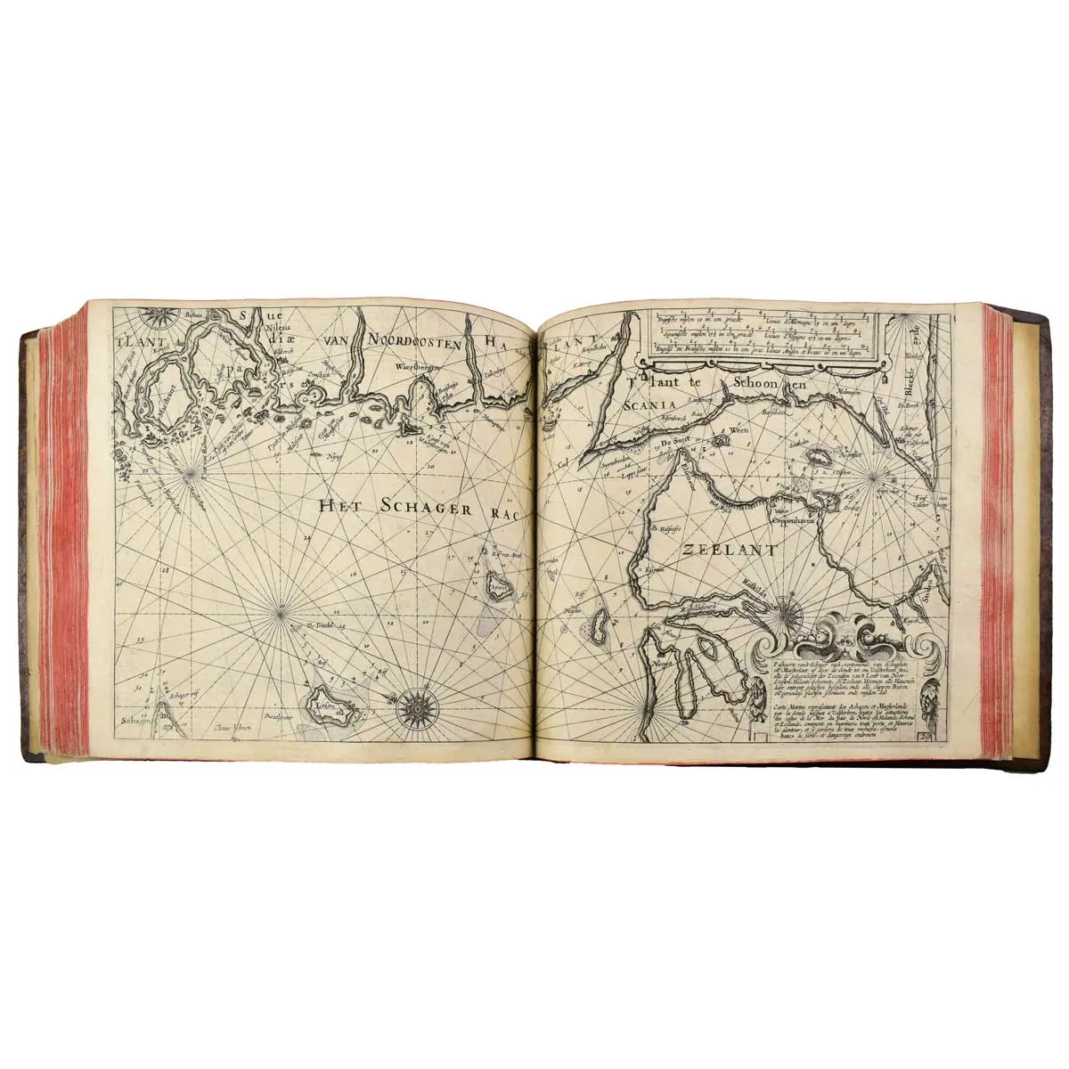
Amsterdam, J. Janssonius, 1620. Oblong 4to (275 x 300 mm). Three parts in one volume. First French edition of Blaeu's pilot book published by Jan Janssonius. With illustrated engraved title (with printed overslip), engraved frontispiece, 42 (40 double-page, 2 folding) engraved maps, 2 woodcut title vignettes, numerous diagrams (incl. 2 volvelles) and coastal profiles in text, Contemporary Full Panelled Calf Gilt, Gilt Device on Upper and Lower Covers.
Amsterdam, J. Janssonius, 1620. Oblong 4to (275 x 300 mm). Three parts in one volume. First French edition of Blaeu’s pilot book published by Jan Janssonius. With illustrated engraved title (with printed overslip), engraved frontispiece, 42 (40 double-page, 2 folding) engraved maps, 2 woodcut title vignettes, numerous diagrams (incl. 2 volvelles) and coastal profiles in text, Contemporary Full Panelled Calf Gilt, Gilt Device on Upper and Lower Covers.
FIRST FRENCH EDITION of Blaeu’s extremely rare pilot book Het licht der zee-vaert published by his competitor Jansson, the charts faithfully copied by Petrus Kaerius, 14 of which are composed of two sheets joined together. The three parts consist of Introduction, an instruction in the art of navigation, the first Book dealing with the Western navigation and the second Book dealing with the Eastern and Northern navigation. The fine engraved frontispiece depicts a lesson in hydrography and the left-hand figure on the engraved title is reputed to be a portrait of William Blaeu. The original Dutch version, Het licht der zee-vaert, was published by Willem Janszoon Blaeu in 1608. Blaeu published a French translation in 1619. For the present edition, Jansson reproduced Blaeu’s text on his own press and had the plates reingraved with some minor alterations.
“Twelve years after the first edition (1608)… Joannes Janssonius issued the same work, composed and printed on his own presses and supplemented with charts, printed from his own plates which are faithful copies of Blaeu’s plates, engraved by Petrus Kaerius. Obviously, copyrights and privileges did not prevent this imitation… The existence of two concurrent publications of this pilot book is one of the most preculiar (sic) facts in the history of Dutch maritime cartography” (Koeman IV, S. 267).
Begins with an introductory part for navigation illustrated with text woodcuts as well as a mounted copperplate with Volvelle and another woodcut Volvelle. This is followed by the description of the sea routes and coasts of the European North Atlantic as well as the North Sea and Baltic Sea, richly illustrated with the corresponding sea and coastal maps as well as numerous coastal profiles in the text. The charts follow the description under Koeman M.Bl 15.
Koeman IV, M.Bl 23 (J); Shirley, M.JAN-1a.