
 Marshall Rare Books
Orbis Vetus, et Orbis Veteris, utraque Continens, Terrarumq Tractus Arcticus et Antarcticus
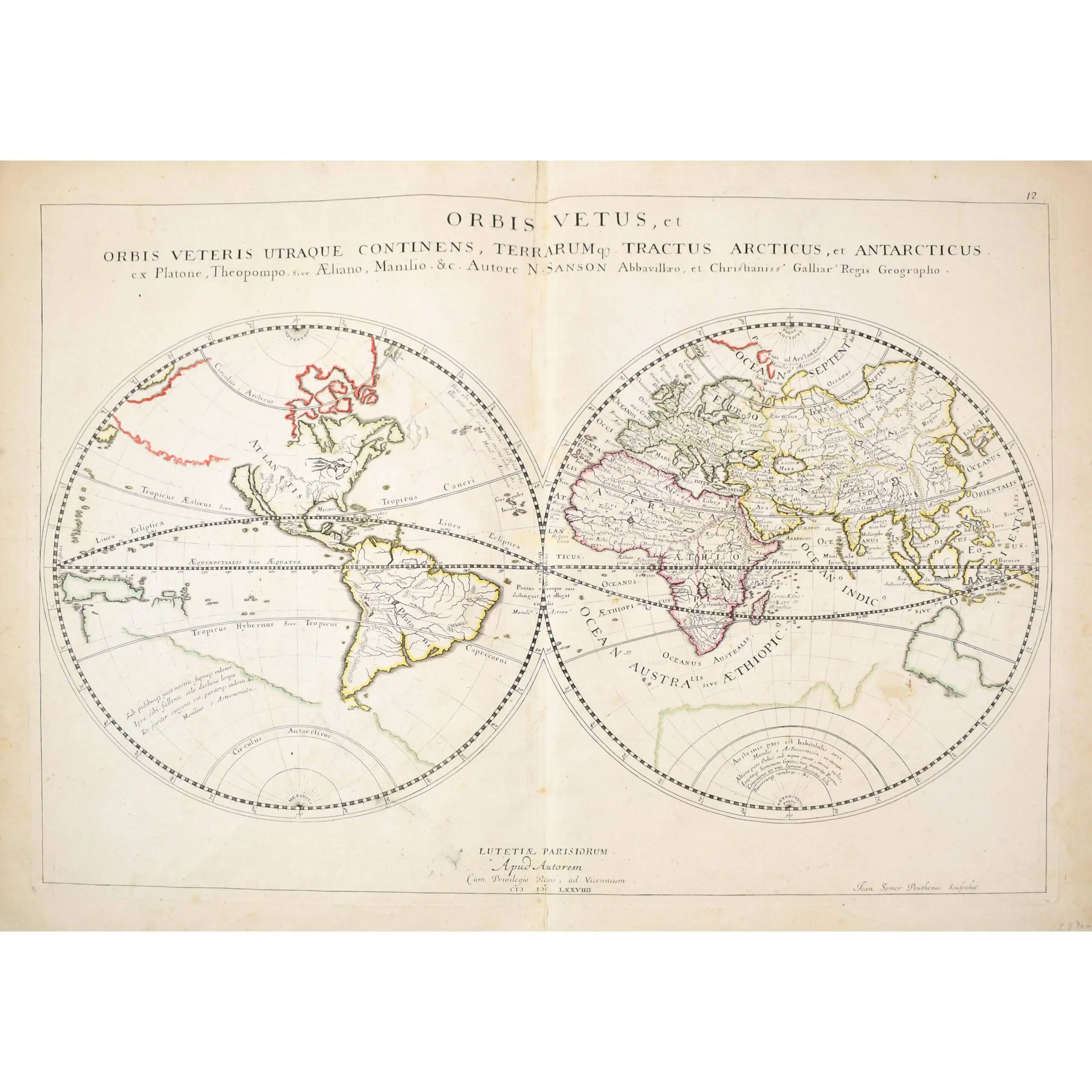
Copper engraved twin hemisphere map, outlined in colour, marginal toning, central vertical fold, Paris, 1657.
Copper engraved twin hemisphere map, outlined in colour, marginal toning, central vertical fold, Paris, 1657.
Sanson’s important folio map of the ancient world, represents the most up to date cartographic information available in the mid 17th Century. Numerous place names in Europe and Asia, the New World is named Plato’s ‘Atlantis Insula’. While California is depicted as an island. The Great Lakes shown here are based on Sanson’s map of North America, the first printed map to depict the Great Lakes. The North Polar information is also very accurate for the period. A massive fictitious southern continent is still shown, with a vague Australia region.
Featured on this map is a second potential northwest passage, shown above Japan. This would in fact be a more accurate reflection of the location and geography of the Bering Straits than most other models of the period. The map was first issued separately in 1657 and thereafter in Sanson’s atlases for the next 20 years.