
 Marshall Rare Books
Prima pars descriptionis itineris navalis in Indiam Orientalem
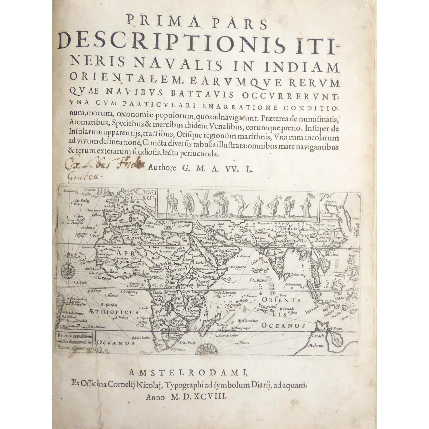
Prima pars descriptionis itineris navalis in Indiam Orientalem Amsterdam,: Cornelis Nicolaus, 1598. Tall quarto, with a total of 49 inset engravings (including 7 maps), 12 pages featuring woodcut coastal profiles, also bound with the scarce plate depicting a bazaar; generally in really good condition, bound in contemporary red calf, rebacked,First Latin edition of the first published account of the first Dutch trading fleet to the East Indies.
Amsterdam,: Cornelis Nicolaus, 1598. Tall quarto, with a total of 49 inset engravings (including 7 maps), 12 pages featuring woodcut coastal profiles, also bound with the scarce plate depicting a bazaar; generally in really good condition, bound in contemporary red calf, rebacked,First Latin edition of the first published account of the first Dutch trading fleet to the East Indies.
This account was written by Lodewijcksz, who sailed under Cornelius de Houtman and Pieter Dirckz on their pioneering trading voyage to South-east Asia in 1595-7, an expedition which saw them trade at the great pepper port of Bantam, quite close to where Batavia was later founded, as well as providing first-hand information about the north coast of Java, Sunda Strait, and Bali.This strategic push ultimately meant that the theories about a Great Southern Land would be tested against the reality of the Australian coast, so it is fitting that the world map on the title-page still carries the last vestiges of Marco Polo, the coastline marked “Beach”, “Lucach”, and “Maletur”. ‘Lodewijcksz depicts the island of Bali in recognizable form for the first time, both on the general map and on a separate map of the island in his book.’ The crew was so delighted with the island that they wanted to call it “New Holland” (Su·rez, Early Mapping of Southeast Asia, p. 183).
The trading fleet of de Houtman and Dirckz comprised four ships, three of which returned to the Netherlands in 1597. Although not a great financial success, this venture confirmed the waning influence of the Portuguese, directly leading to the seventeenth-century Dutch incursions into the region: as Howgego notes, in 1598, the same year this work was published, no fewer than 25 ships were sent out to the Indies, and the Dutch East India Company was established in 1602. It was in 1605 that Willem Jansz and another Lodewijcksz, Jan Lodewycksz van Roosengin, sailed on the Duyfken to Cape York.The most significant geographical achievement of Houtman’s voyage was that by sailing round Java it proved that this island could not be part of the supposed southland (see Schilder, Australia Unveiled, ch. VI). The map on the title-page shows the oceans and coasts navigated between Europe and the East Indies, including the promontory of a southern continent, with the names ‘Beach’, ‘Lucach’, ‘Maletur’, in close proximity to an island, ‘Java Minor’.’Like the English, Houtman’s men suffered so severely from scurvy that they had to put in at the Cape of Good Hope and at Antongil Bay in Madagascar to recuperate.
They then sailed straight across the Indian Ocean to the Straits of Sunda and dropped anchor at Bantam in Java without the loss of a ship. At this port, the center of the Javanese pepper trade, a long time was spent. Both natives and Portuguese showed considerable hostility, and Houtman and some of his men were imprisoned. However, the Dutch succeeded in making a commercial treaty and departed with a good cargo. They proceeded eastward to Bali, and then returned along the south coast of Java, thereby acquiring a more correct impression of the width of the island than had prevailed and laid the ghost of Java’s being the northern part of the Southern Continent… the Dutch skipper had enough to show for his venture to inspire the merchants of Amsterdam with a determination to exploit the trade…’ (Penrose, Travel and Discovery in the Renaissance).