
 Marshall Rare Books
Warre's Sketches in North America and the Oregon Territory
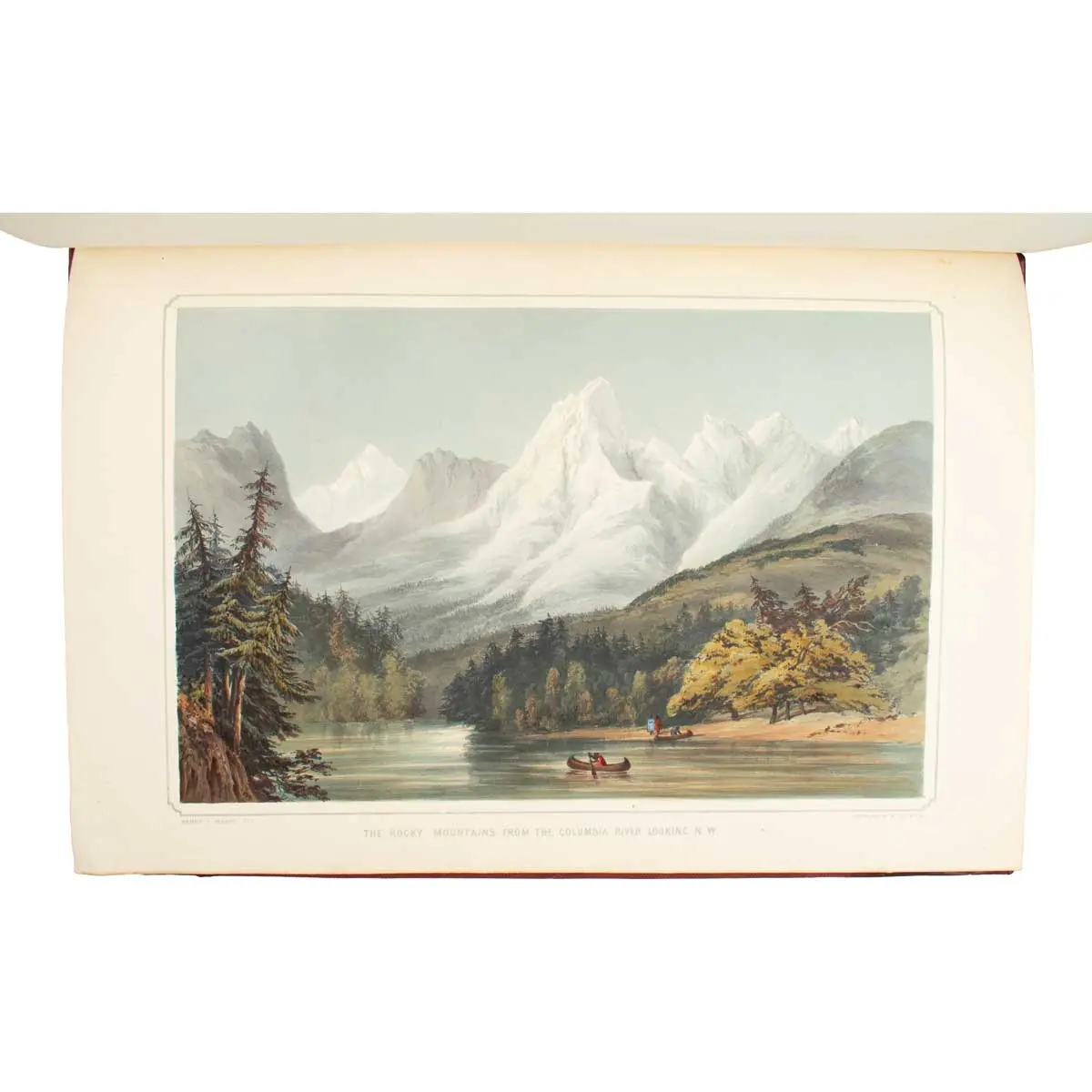
ONE OF THE FINEST COLOUR-PLATE BOOKS OF THE AMERICAN WEST
London, Dickinson & Co, 1848. Folio (530 x 370 mm), Contemporary Red half Morocco Gilt, Gilt Title to Upper Cover, hinges repaired, 20 hand-coloured lithographs on 16 sheets, one lithographed map, with text and letterpress title,
First edition, A Fine Copy of the Rare Hand-Coloured issue, highlighted with gum Arabic
of this magnificent series of Pacific Northwest views. This copy includes the dedication leaf to Hudson’s Bay Company, which according to Howes was not issued with all copies.
Warre travelled the Oregon territory in 1845 on behalf of the British Government. They sought to settle a territorial dispute with the Americans for which war seemed imminent. Upon his return, the matter was already resolved.
“With Bodmer’s atlas and Catlin’s Portfolio, this is one of the very few colour-plate books on a large scale to depict the American West.
Scenes include Falls of the Peloos River, the Rocky Mountains, the Dalles on the Columbia River, the Rocky Mountains from the Columbia River, Distant View of the Rocky Mountains, the American Village, Falls of the Kamanis on Taquoih River, Source of the Columbia River, Valley of the Willamette River, Mount Hood from Les Dalles, Fort Garry, Mount Hood, Fort George (Astoria), McGillivray River, Mount Baker, Cape Disappointment, Fort Vancouver, Indian Tomb, Buffalo Hunting on the Western Prairies, and Forcing a passage through the burning Prairie” (Best of the West).
General Sir Henry James Warre (1819-1898) was born in South Africa and eventually served as an army officer in British North America. He served as Aide-de-Camp to his uncle, Sir R. D. Jackson, Commander-in-Chief of the Forces.
Abbey Travel 656; Best of the West 105; Graff 4542; Hill 1827; Howes W-114 (“c” = “quite rare”); Sabin 101455; Wagner-Camp 157.