
 Marshall Rare Books
World Map
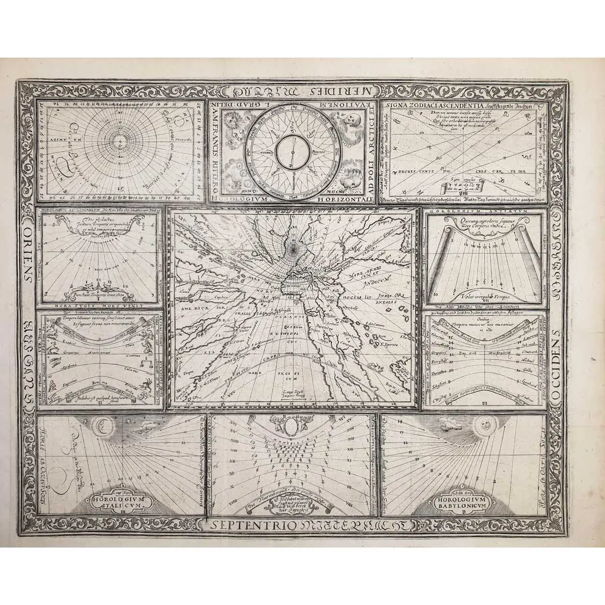
FIRST Edition, first state, copper engraved world map, from Ritter’s ‘Speculum Solis’, world map on a sundial projection, bordered by 10 inset horological diagrams, all enclosed in a decorative border, central vertical fold, large margins, overall size 285 x 360mm, Nuremberg, 1607
FIRST Edition, first state, copper engraved world map, from Ritter’s ‘Speculum Solis’, world map on a sundial projection, bordered by 10 inset horological diagrams, all enclosed in a decorative border, central vertical fold, large margins, overall size 285 x 360mm, Nuremberg, 1607
A rare and extremely unusual map shows the world projected from the North Pole as if it were the table of a sundial. Although at first glance it appears as if the landmasses are melting off the earth, they are actually drawn to scale based on a mathematical projection that links time and location. Ritter uses a gnomonic projection, in which surface points of a sphere are projected from the center of the earth onto a tangent plane. Meridians and the Equator are shown as straight lines, while all other parallels are depicted as ellipsis, parabolas or hyperbolas. In order to use the map to tell time, the center point would be 45°N 10°E, from which point a shadow would be cast onto a meridian to indicate the local sun time. The gnomonic projection was originally called horologium due to its relationship to sundials.
The result is a very distorted, though mathematically correct, projection, with the distortion increasing rapidly away from the center point. The geography on the map is limited to major rivers and a few place names, including Florida in North America and the fabled golden city of Manoa on the mythical Parime Lacus in South America. The British Isles are curiously omitted, despite numerous small islands dotting the Atlantic. One small sea monster graces the waters between Africa and Madagascar.
In 2017, this map was exhibited in “Regions and Seasons: Mapping Climate through History” organized by the Norman B. Leventhal Map Center at the Boston Public Library. It was included as the winds are one of the features illustrated. The four principal winds are represented encircling a compass, with north at the south. “Destructive” winds in the south are illustrated here as skulls, indicating the negative effects they were believed to have on humankind.
Surrounding the central map are ten horological diagrams, all enclosed in a decorative border. These diagrams include a windrose at top centre (bearing the date Anno MDCVII), signs of the zodiac, and sundials for morning, midday and evening hours. The plate was designed for Ritter’s first edition of the Speculum Solis in 1607, and is a synopsis of all the plates that appear in his later editions. This is the first state.
Franz Ritter (born in Nuremberg, died 1640) was an astronomer and innovative cartographer, famous for his ‘sundial’ world map. He had studied under Johann Praetorius at the University of Altdorf. Ritter specialized in the design and manufacture of astrolabes, sundials, and other astronomical, horological and cartographical instruments.